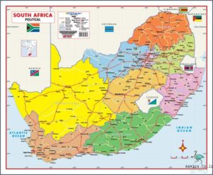
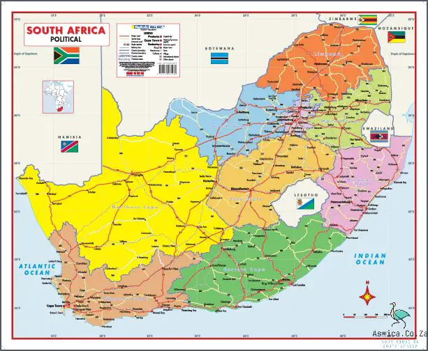
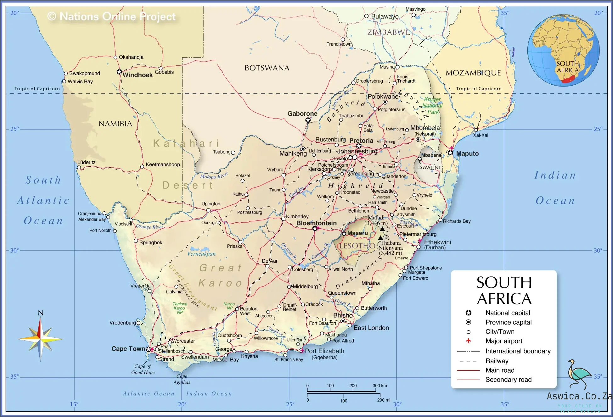
South Africa Political Map is an important tool to understand the political divisions of the country. This map shows the boundaries of the various provinces and metropolitan areas, as well as the major cities in each region. It also highlights the major rivers, mountains, and other geographical features of South Africa. The map also displays the national parks, game reserves, and other protected areas. In addition to this, the map also depicts the major transportation networks and highways, allowing for easy navigation around the country. The map is an invaluable tool for those looking to learn more about the political divisions of South Africa and its various regions.
Contents
South Africa Political Map
South Africa is a large country located in southern Africa. It is bordered by the Atlantic and Indian Oceans, Namibia, Botswana, Zimbabwe, Mozambique, Swaziland and Lesotho. The South Africa political map shows the nine provinces of the country, with each province having its own capital city. The provinces are Gauteng, KwaZulu-Natal, Eastern Cape, Western Cape, Limpopo, Mpumalanga, North West, Northern Cape, and Free State. The map also shows the major cities and towns, as well as the international borders, rivers and mountain ranges. The map also illustrates the major highways, railways and air routes which connect the country to the rest of the world.
Geography of South Africa – Outline of the physical geography of the country
South Africa is a land of vast and varied physical geography, offering an array of landscapes and climates. From the rolling plains of the grasslands and savannas, to the rugged mountains of the highlands, the country is home to a variety of topographical features. Its physical geography is divided into three main regions: the interior plateau, the coastal lowlands, and the mountain ranges.
The interior plateau is the largest region and is situated in the middle of the country, stretching from the Kalahari Desert in the west to the Drakensberg Mountains in the east. This region consists of a series of rolling hills and plains, dotted with salt pans and shallow lakes. The climate here is arid to semi-arid, with some areas receiving limited rainfall.
The coastal lowlands are located along the southern and eastern coasts of South Africa. This region is covered with tropical and subtropical vegetation, and experiences a hot, humid climate with high rainfall. The coastal lowlands are also home to some of South Africa’s major cities, including Durban, Port Elizabeth, and Cape Town.
The mountain ranges of South Africa are located in the southwestern part of the country. This region consists of the Cape Fold Mountains, the Drakensberg Mountains, the Great Escarpment, and the Magaliesberg Mountains. These ranges are home to a variety of habitats, including grasslands, subtropical forests, and alpine meadows. The climate is cool and temperate, with higher altitudes receiving more rainfall.
The South African political map is divided into nine provinces, each with its own unique geographical features and climate. The provinces are Gauteng, Limpopo, North West, Mpumalanga, KwaZulu-Natal, Eastern Cape, Western Cape, Northern Cape, and Free State. Each province has its own landscape, from the lush coastal lowlands of KwaZulu-Natal to the rugged mountain ranges of the Western Cape.
South Africa is a land of remarkable geographical diversity, with its array of landscapes and climates. From the grasslands of the interior plateau to the subtropical forests of the coastal lowlands, and the rugged mountain ranges of the south, the country has something to offer everyone. With its vibrant political map, South Africa is a land of adventure and exploration.
Political Divisions – Overview of the various political divisions in the country
South Africa is divided into nine provinces, each with its own unique history, culture, and political divisions. The provinces include the Eastern Cape, Free State, Gauteng, KwaZulu-Natal, Limpopo, Mpumalanga, North West, Northern Cape, and Western Cape. Each province is further divided into municipalities and local government areas, which are responsible for the management of local services, such as health, education, and public safety.
The South African political map is a complex one. The country is divided into three major regions: the Republic of South Africa (RSA); the Republic of Bophuthatswana (RBB), and the Republic of Ciskei (RCC). Within each of these regions, there are further divisions between provinces, districts, and local government areas.
The Republic of South Africa is the largest of the three regions and is divided into nine provinces. It is the most economically developed region and is host to the largest cities in the country. The two former independent homelands, Bophuthatswana and Ciskei, are located within the RSA.
The Republic of Bophuthatswana is located in the northern part of the country, bordering Botswana and Mozambique. It is divided into eight districts, each with its own local government. It is the least economically developed region of the country, but is home to the famous Sun City casino and resort.
The Republic of Ciskei is located in the eastern part of South Africa, bordering the Indian Ocean. It is divided into five districts and is the poorest region in the country. It is home to many small rural villages, but also to some of the most important industrial and commercial centers in the country.
The South African political map is an intricate one, and understanding the various divisions within the country is essential to understanding its history and culture. Each region has its own unique set of laws and customs, and it is important to understand the differences between them in order to fully appreciate the country’s rich diversity.
Major City-States – Overview of the major city-states in South Africa
South Africa is home to some of the most vibrant and bustling citystates in the world. From the bustling metropolises of Johannesburg and Durban to the small towns and rural areas, South Africa has a diverse landscape of cities and towns that all contribute to its unique culture. From major economic hubs to small, rural settlements, South Africa has something for everyone.
In this article, we’ll take a look at some of the major citystates in South Africa. From the capital city, Pretoria, to the other major cities and towns, this overview will help you identify the major citystates in South Africa and the unique characteristics that make them special.
Pretoria is the administrative capital of South Africa and is also home to many of the country’s major universities and research institutions. The city is a major economic hub and has a vibrant business, cultural and educational scene. Pretoria is also home to a number of parks, museums and other attractions that make it a popular tourist destination.
Johannesburg is South Africa’s largest city and is the country’s commercial and financial center. It is also home to the largest port in the country and is a major hub for international trade. Johannesburg is known for its diverse cultural attractions, including the famous Soweto Township.
Durban is the third-largest city in South Africa and is known for its beautiful beaches and warm weather. It is a major port city and is home to a large number of cultural and entertainment venues. Durban is also an important industrial and manufacturing center and is home to a number of industries, including automotive, chemical, and pharmaceutical.
Cape Town is the legislative capital of South Africa and is known for its stunning natural beauty. It is home to the iconic Table Mountain and is a major tourist destination. Cape Town is also a major port city and is home to a number of industries, including pharmaceuticals, engineering, and finance.
Port Elizabeth is the fifth-largest city in South Africa and is known for its beautiful beaches and scenic coastline. It is a major port city and is home to a number of industries, including chemical, automotive, and engineering.
Bloemfontein is the sixth-largest city in South Africa and is known for its rich cultural heritage and vibrant nightlife. It is home to many museums and galleries and is a major educational center.
Kimberley is the seventh-largest city in South Africa and is home to a number of diamond mines. It is also a major tourist destination and is home to a number of cultural attractions.
These are just some of the major citystates in South Africa. Each of these cities has its own unique culture, history and attractions, making them all worth exploring. Whether you’re looking for a bustling metropolis or a more laid-back rural town, South Africa has something for everyone.
Conclusion
The South Africa Political Map provides a comprehensive overview of the country’s political landscape. It depicts the provinces, cities, and towns as well as major roads and railroads. It also includes important geographic features such as rivers, lakes, and mountains. In addition, it shows the borders of South Africa’s nine provinces and their capitals. The map is useful to anyone who wishes to understand the political divisions of South Africa and the overall geography of the country. With its detailed information and visual representation, the South Africa Political Map is an invaluable tool for anyone looking to understand the political, geographic, and cultural aspects of South Africa.
