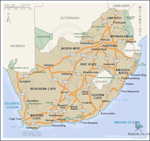
The South African National Roads Map is a compilation of all the national roads in South Africa. The map is divided into nine provinces and includes the full national road network, as well as all the major town and city centres. The map also includes the major tourist destinations and major transport hubs, making it an essential tool for travellers and drivers.
Contents
South African National Roads Map
The South African National Roads Map is an invaluable tool for anyone travelling in South Africa. It shows all major highways, roads and freeways, as well as smaller provincial and district roads. It also includes local points of interest such as gas stations, towns, and places of interest. It is an essential guide for anyone travelling around the country, giving them a comprehensive overview of the country’s road network. It can be used to plan out the most efficient route and ensure a safe journey. Furthermore, it helps to familiarise oneself with the variety of road signs and regulations that exist in South Africa. The South African National Roads Map is an essential tool for anyone looking to explore the beautiful country of South Africa.
History of South African roads
The history of South African roads is one that stretches back centuries and is intrinsically intertwined with the nation’s tumultuous past. From the earliest colonial expansion to the modern-day motorways, South African roads have played a major role in the development of the nation.
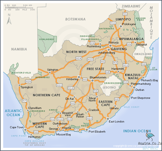
The earliest roads in South Africa were built by Dutch settlers in the mid-17th century. These roads were designed to link the Cape Colony with the rest of the Dutch East India Company’s far-flung colonies, reaching as far inland as the Great Fish River. The roads were primitive, little more than dirt tracks, but they served as the lifeblood of the nation, linking the various settlements and allowing for the transport of goods and people.
The road network expanded during the 19th century as the British Empire began to occupy the Cape Colony. The British built a number of new roads that linked the major settlements and allowed for the transport of troops and supplies. The roads also allowed for the spread of the British imperial influence and paved the way for the colonization of the interior of the country.
The 20th century saw the construction of a number of new roads, including the construction of the N1, which runs from Cape Town to Johannesburg. This was the first major motorway in South Africa, linking the two major cities and allowing for the transport of goods and people more quickly and efficiently.
In more recent years, the South African government has made a concerted effort to upgrade the existing road network. The National Roads Map was published in 2008, outlining a plan for the development of the country’s road infrastructure. This plan has seen the construction of new motorways and the upgrading of existing roads, allowing for the efficient transport of people and goods between the major cities.
The history of South African roads is one that is deeply intertwined with the nation’s history. From the primitive dirt tracks of the Dutch settlers to the modern motorways of today, South African roads have played a major role in the development of the nation. As the country continues to move forward, the road network will no doubt remain a crucial element of the nation’s infrastructure.
Map of South African roads
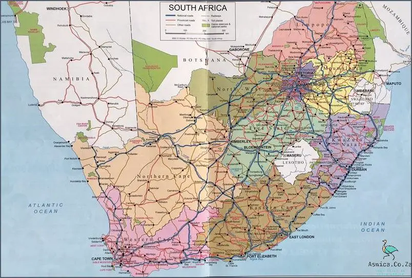
The South African National Roads Map is an incredibly useful tool for navigating the country’s vast and diverse terrain. Spanning over 1.2 million kilometers of roads, the map provides an invaluable resource for travelers, road trip enthusiasts, and everyday citizens alike.
The map is divided into three distinct geographic regions: the N1, N2, and N3. The N1 is the longest route, stretching from the coastal town of Mossel Bay in the Western Cape, all the way up to Beitbridge on the border of Zimbabwe. The N2, also known as the Garden Route, is a popular tourist route that runs from Cape Town to Durban. The N3 route is a major arterial highway, connecting Durban to Johannesburg.
The South African National Roads Map also includes several categories of national roads. These include the main national roads, regional roads, and rural roads. Main national roads are the most heavily used and are generally well maintained. Regional roads are typically smaller and less travelled, but are still important for connecting towns and cities. Finally, rural roads are generally narrow and unpaved, and provide access to more remote areas.
The South African National Roads Map also includes information about road safety and road rules. It details speed limits, the proper use of road signs, and other traffic regulations. It also provides information about roadside services, such as fuel stations, rest stops, and emergency services. As a result, the map can be an invaluable resource for anyone travelling through South Africa.
The South African National Roads Map is an invaluable resource for travelers and citizens alike. With its detailed information about roads and road rules, it can be a useful tool for navigating the country’s expansive terrain. Whether you are planning a road trip or just need to get from A to B, the South African National Roads Map is an invaluable tool.
Types of Roads in South Africa
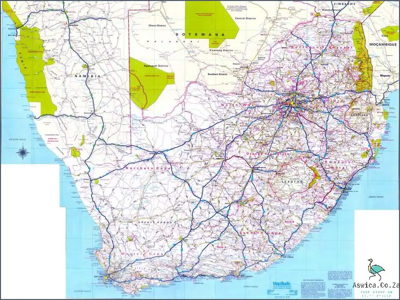
The Republic of South Africa boasts a vast network of roads that traverse the entire country. From the bustling cities of Johannesburg and Cape Town to the rolling hills of the countryside, the national roads map of South Africa offers a range of opportunities for travelers. But with so many roads to choose from, it can be difficult to determine which one is right for your journey. Here, we take a look at the types of roads in South Africa, so you can plan your route with ease.
The main type of road in South Africa is the national road, which is also known as the N1, N2, N3, N4 and N5. These roads are the most well-maintained and offer a direct route from one major city to another. They are often the quickest way to travel and are the most heavily trafficked.
In addition to the national roads, there are also provincial roads, which are not as well-maintained and are more suitable for shorter trips. These roads are generally slower and more winding, but offer a unique experience for travelers looking to explore the country’s stunning countryside.
The last type of road in South Africa is the regional roads, which are the least maintained but often offer the most scenic routes. These roads are perfect for those looking to take a leisurely drive and experience the country’s natural beauty.
No matter what type of road you choose, South Africa offers an incredible range of routes to explore. From the bustling cities to the peaceful countryside, the national roads map of South Africa has something for everyone. Plan your trip today and take your pick of the many types of roads in South Africa.
Conclusion
The South African National Roads Map provides a comprehensive overview of the national road network in South Africa. It highlights the major highways and inter-city routes, as well as the smaller secondary roads. The map also provides detailed information about the road widths, speed limits, and other important features. The map is an invaluable tool for those travelling in South Africa, providing an easy way to find out which roads to take and when to take them. The South African National Roads Map is an essential resource for all travelers in the country, and provides an essential way to navigate the roads of South Africa.
